Rahman, Alias Abdul
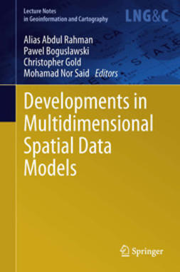
Developments in Multidimensional Spatial Data Models
1. Medial Axis Approximation of River Networks for Catchment Area Delineation
Farid Karimipour, Mehran Ghandehari, Hugo Ledoux
2. Representing the Dual of Objects in a Four-Dimensional GIS
Ken Arroyo Ohori, Pawel Boguslawski, Hugo Ledoux
3. Calibration and Accuracy Assessment of Leica ScanStation C10 Terrestrial Laser Scanner
Mohd Azwan Abbas, Halim Setan, Zulkepli Majid, Albert K. Chong, Khairulnizam M. Idris, Anuar Aspuri
4. A Methodology for Processing Raw LiDAR Data to Support Urban Flood Modelling Framework: Case Study—Kuala Lumpur Malaysia
Ahmad Fikri Abdullah, Zoran Vojinovic, Alias Abdul Rahman
5. Potential of Multiscale Texture Polarization Ratio of C-band SAR for Forest Biomass Estimation
Latifur Rahman Sarker, Janet Nichol, Ahmad Mubin
6. Reliability of a High Accuracy Image-Based System for 3D Modelling of the Medial Longitudinal Arch During Gait
Duaa Alshadli, Albert K. Chong, Kevin McDougall, Jasim Al-Baghdadi, Peter Milburn, Richard Newsham-West
7. WorldView-2 Satellite Imagery and Airborne LiDAR Data for Object-Based Forest Species Classification in a Cool Temperate Rainforest Environment
Zhenyu Zhang, Xiaoye Liu
8. Unmanned Aerial Vehicle Photogrammetric Results Using Different Real Time Kinematic Global Positioning System Approaches
Khairul Nizam Tahar, Anuar Ahmad, Wan Abdul Aziz Wan Mohd Akib, Wan Mohd Naim Wan Mohd
9. Towards Enhancing Geometry Textures of 3D City Elements
Behnam Alizadehashrafi, Alias Abdul Rahman
10. Examination of Compatibility Between the Croatian Land Administration System and LADM
Nikola Vučić, Miodrag Roić, Zdravko Kapović
11. GIS Application and Geodatabase for Archaeological Site Documentation System: Bujang Valley, Malaysia
Erna Warnita Bachad, Zulkepli Majid, Halim Setan, Albert K. Chong, Nurul Shahida Sulaiman
12. A Review and Conceptual Framework for Generalization of Maps
Siddique Ullah Baig, Alias Abdul Rahman, Edward Eric Duncan
13. Methods for Georeferencing Point Cloud of Building From Static TLS: A Review
Rizka Akmalia, Halim Setan, Zulkepli Majid, Deni Suwardhi
14. CityGML for Architectural Heritage
Erik Costamagna, Antonia Spanò
15. Towards Efficient Putrajaya 3D SDI Using Schema-Aware Compressor for CityGML
Siew Chengxi Bernad, Alias Abdul Rahman
Nyckelord: Geography, Geographical Information Systems/Cartography, Natural Hazards, Remote Sensing/Photogrammetry
- Författare
- Rahman, Alias Abdul
- Boguslawski, Pawel
- Gold, Christopher
- Said, Mohamad Nor
- Utgivare
- Springer
- Utgivningsår
- 2013
- Språk
- en
- Utgåva
- 2013
- Serie
- Lecture Notes in Geoinformation and Cartography
- Sidantal
- 10 sidor
- Kategori
- Naturvetenskaper
- Format
- E-bok
- eISBN (PDF)
- 9783642363795


