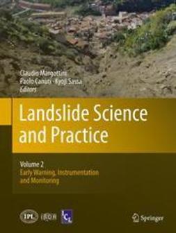
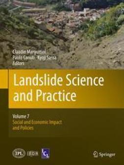
Margottini, Claudio
Landslide Science and Practice
Part I. Landslide Inventory and Susceptibility and Hazard Zoning
1. From Landslide Inventories to Landslide Risk Assessment; An Attempt to Support Methodological Development in India
Cees J. Westen, Saibal Ghosh, Pankaj Jaiswal, Tapas Ranjan Martha, Sekhar Lukose Kuriakose
2. Mapping a Nation’s Landslides: A Novel Multi-Stage Methodology
Hannah Evans, Catherine Pennington, Colm Jordan, Claire Foster
3. Systematic Mapping of Large Unstable Rock Slopes in Norway
Reginald L. Hermanns, Lars H. Blikra, Einar Anda, Aline Saintot, Halgeir Dahle, Thierry Oppikofer, Luzia Fischer, Halvor Bunkholt, Martina Böhme, John F. Dehls, Tom R. Lauknes, Thomas F Redfield, Per T. Osmundsen, Trond Eiken
4. Landslide Databases in Europe: Analysis and Recommendations for Interoperability and Harmonisation
Miet Eeckhaut, Javier Hervás, Luca Montanarella
5. Working with Landslide Inventories and Susceptibility Maps in Lower Austria
Joachim Schweigl, Wolfgang Straka
6. Landslide Inventory at 1:10,000 Scale in Poland: Benefits and Dilemmas of a National Project
Teresa Mrozek, Antoni Wójcik, Ziemowit Zimnal, Dariusz Grabowski
7. Landslides Along the North-West Coast of the Island of Malta
Stefano Devoto, Sara Biolchi, Viola Maria Bruschi, Alberto González Díez, Matteo Mantovani, Alessandro Pasuto, Daniela Piacentini, John A. Schembri, Mauro Soldati
8. Developments in Landslides Inventory and Registry in Slovakia
Pavel Liščák, Štefan Káčer
9. Landslide Impacts in Europe: Weaknesses and Strengths of Databases Available at European and National Scale
Daniele Spizzichino, Claudio Margottini, Alessandro Trigila, Carla Iadanza
10. The Use of PSInSAR™ and SqueeSAR™ Techniques for Updating Landslide Inventories
Claudia Meisina, Davide Notti, Francesco Zucca, Massimo Ceriani, Alessio Colombo, Flavio Poggi, Anna Roccati, Andrea Zaccone
11. Combining Multiple Change Detection Indices for Mapping Landslides Triggered by Typhoons
Alessandro C. Mondini, Kang-tsung Chang, Hsiao-Yuan Yin, Fausto Guzzetti
12. Very-High Resolution Stereoscopic Satellite Images for Landslide Mapping
Francesca Ardizzone, Federica Fiorucci, Michele Santangelo, Mauro Cardinali, Alessandro Cesare Mondini, Mauro Rossi, Paola Reichenbach, Fausto Guzzetti
13. Mapping of Landslides Under Dense Vegetation Cover Using Object-Oriented Analysis and LiDAR Derivatives
Miet Eeckhaut, Norman Kerle, Javier Hervás, Robert Supper
14. Assessment of Landslides Activity in Maily-Say Valley, Kyrgyz Tien Shan
Romy Schlögel, Anika Braun, Almaz Torgoev, Tomas M. Fernandez-Steeger, Hans-Balder Havenith
15. Improving Landslide Inventory with Persistent Scatterers in Calabria, Italy
Silvia Bianchini, Francesca Cigna, Nicola Casagli
16. The Debris Flows Inventory of the Aosta Valley Region: An Integrated Natural Hazards Assessment
Marco Giardino, Sara Ratto, Mauro Palomba, Walter Alberto, Marco Armand, Martina Cignetti
17. The Integration Between Satellite Data and Conventional Monitoring System in Order to Update the Arpa Piemonte Landslide Inventory
Luca Lanteri, Alessio Colombo
18. Landslide Inventory and Susceptibility Mapping in a Mexican Stratovolcano
Gabriel Legorreta Paulín, Marcus Bursik, M. T. Ramírez-Herrera, J. Lugo-Hubp, J. J. Zamorano Orozco, I. Alcántara-Ayala
19. Landslide Mapping Using SqueeSAR Data: Giampilieri (Italy) Case Study
Federico Raspini, Sandro Moretti, Nicola Casagli
20. Landslide Inventory in the Area of Zagreb City: Effectiveness of Using LiDAR DEM
Snježana Mihalić, Hideaki Marui, Osamu Nagai, Hiroshi Yagi, Toyohiko Miyagi
21. Usage of ASTER Level 3A Stereo Data in Landslide Inventory Mapping: Visual Determination Versus Fieldwork
Tolga Alkevli, Murat Ercanoğlu
22. Mechanism and Triggering Factors of the Maierato (VV) Landslide
Paola Gattinoni, Laura Scesi
23. Multidisciplinary Study of the Torrio Landslide (Northern Apennines, Italy)
Giulio Masetti, Giuseppe Ottria, Franco Ghiselli, Aldo Ambrogio, Gianluca Rossi, Lanfranco Zanolini
24. Advance in the Mapping of the 1717 AD Triolet Rock Avalanche Deposit (Mont Blanc Massif, Italy) Using Cosmogenic Exposure Dating
Philip Deline, Naki Akçar, Susan Ivy-Ochs, Vasily Alfimov, Irka Hajdas, Peter W Kubik, Marcus Christl, Christian Schlüchter
25. Amplification of the Destructive Effects of Rock Falls by Sliding on Volcanic Soils: Examples from the Anaga Massif (Tenerife Island, Spain)
Jorge Yepes Temiño, Martín Jesús Rodríguez-Peces, Sara Marchesini, Sergio Leyva, José Luis Díaz-Hernández
26. Creation of Landslide Inventory Map for the Toktogul Region of Kyrgyzstan, Central Asia
Namphon Khampilang, Malcolm Whitworth
27. Residual Strength Measurements for Some British Clays
Seyyedmahdi Hosseyni, Nobuyuki Torii, Edward N. Bromhead
28. Gravitational Processes in the Eastern Flank of the Nevado de Toluca México
José Fernando Aceves-Quesada, Víctor Manuel Martínez Luna, Gabriel Legorreta Paulín
29. Causes of Small Scale Landslides in Flysch Deposits of Istria, Croatia
Željko Arbanas, Sanja Dugonjić, Čedomir Benac
30. Landslide Controlling Factors in Catchments with High Deforestation
Guns Marie, Vanacker Veerle
31. Characterizing Tree Growth Anomaly Induced by Landslides Using LiDAR
Khamarrul A. Razak, Alexander Bucksch, Michiel Damen, Cees Westen, Menno Straatsma, Steven Jong
32. A GIS Method for Obtaining Geologic Bedding Attitude
Ivan Marchesini, Michele Santangelo, Federica Fiorucci, Mauro Cardinali, Mauro Rossi, Fausto Guzzetti
33. DP Test in Geotechnical Characterization of Shallow Landslides Source Area: Results and Perspectives
Giacomo D’Amato Avanzi, Yuri Galanti, Roberto Giannecchini, Susanna Duchi, Diego Lo Presti, Daria Marchetti
34. Quantitative Geomorphological Analysis Based on Wavelet Transforms
Angelo Doglioni, Vincenzo Simeone
35. The Role of Inherited Structures in Deep Seated Slope Failures in Kåfjorden, Norway
Halvor Bunkholt, Tim Redfield, Per Terje Osmundsen, Thierry Oppikofer, Reginald L. Hermanns, John Dehls
36. Tectonics and Large Landslides in the Northern Apennines (Italy)
Alessandro Chelli, Andrea Ruffini, Paolo Vescovi, Claudio Tellini
37. Landslide Inventories for Reliable Susceptibility Maps in Lower Austria
Helene Petschko, Rainer Bell, Philip Leopold, Gerhard Heiss, Thomas Glade
38. Landslide Susceptibility Mapping at National Scale: The Italian Case Study
Alessandro Trigila, Paolo Frattini, Nicola Casagli, Filippo Catani, Giovanni Crosta, Carlo Esposito, Carla Iadanza, Daniela Lagomarsino, Gabriele Scarascia Mugnozza, Samuele Segoni, Daniele Spizzichino, Veronica Tofani, Serena Lari
39. New Developments in Harmonized Landslide Susceptibility Mapping over Europe in the Framework of the European Soil Thematic Strategy
Andreas Günther, Miet Eeckhaut, Paola Reichenbach, Javier Hervás, Jean-Philippe Malet, Claire Foster, Fausto Guzzetti
40. Integrating Spatial Multi-criteria Evaluation and Expert Knowledge for Country-Scale Landslide Susceptibility Analysis: Application to France
Jean-Philippe Malet, Anne Puissant, Alexandre Mathieu, Miet Eeckhaut, Mathieu Fressard
41. Digital Rock-Fall and Snow Avalanche Susceptibility Mapping of Norway
Jan Høst, Marc-Henri Derron, Kari Sletten
42. Mapping Mass Movement Susceptibility Across Greece with GIS, ANN and Statistical Methods
Maria Ferentinou, Christos Chalkias
43. Probabilistic Landslide Hazard for El Salvador
Carlos Eduardo Rodríguez-Pineda, Jairo Yepes-Heredia
44. Hazard Zoning in Areas with Major Deep-Seated Landslides: Case Study from Switzerland
Daniel Tobler, Hans-Rudolf Keusen
45. Overview of Landslide Risk Reduction Studies in Sri Lanka
R. M. S. Bandara, K. M. Weerasinghe
46. Susceptibility Maps for Landslides Using Different Modelling Approaches
Philip Leopold, Gerhard Heiss, Helene Petschko, Rainer Bell, Thomas Glade
47. Using Remotely Sensed Information for Near Real-Time Landslide Hazard Assessment
Dalia Kirschbaum, Robert Adler, Christa Peters-Lidard
48. Modelling Landslides’ Susceptibility by Fuzzy Emerging Patterns
Anna Rampini, Gloria Bordogna, Paola Carrara, Monica Pepe, Massimo Antoninetti, Alessandro Mondini, Paola Reichenbach
49. Analysis of Landslide Susceptibility Using Monte Carlo Simulation and GIS
Heon-Woo Lee, Hyuck-Jin Park, Ik Woo, Jeong-Gi Um
50. An Overview of a GIS Method for Mapping and Assessing Landslide Hazards
Gabriel Legorreta Paulín, Marcus Bursik, José Lugo Hubp
51. Minimal Standards for Susceptibility and Hazard Maps of Landslides and Rock Falls
Gerlinde Posch-Trözmüller, Richard Bäk
52. Hyperconcentrated Flow Susceptibility Analysis and Zoning at Medium Scale: Methodological Approach and Case Study
Leonardo Cascini, Silvio Nocera, Michele Calvello, Sabatino Cuomo, Settimio Ferlisi, Fabio Matano
53. Inventory of Landslide Risk to Limit Consequences of Climate Change
Marius Tremblay, Karin Lundström, Victoria Svahn, Charlotte Cederbom
54. Probability Maps of Landslide Reactivation Derived from Tree-Ring Records
Jérôme Lopez Saez, Christophe Corona, Frédéric Berger
55. Radargrammetric Generation of DEMs from High Resolution Satellite SAR Imagery: A New tool for Landslide Hazard and Vulnerability Assessment
Paola Capaldo, Mattia Crespi, Francesca Fratarcangeli, Andrea Nascetti, Francesca Pieralice
56. Slope Angle as Indicator Parameter of Landslide Susceptibility in a Geologically Complex Area
Angelo Donnarumma, Paola Revellino, Gerardo Grelle, Francesco Maria Guadagno
57. The Susceptibility Map for Landslides with Shallow Initiation in the Emilia Romagna Region (Italy)
Mauro Generali, Marco Pizziolo
58. Methods for Shallow Landslides Susceptibility Mapping: An Example in Oltrepo Pavese
Claudia Meisina, Davide Zizioli, Francesco Zucca
59. Application of GIS Techniques for Landslide Susceptibility Assessment at Regional Scale
Goffredo Manzo, Veronica Tofani, Samuele Segoni, Alessandro Battistini, Filippo Catani
60. Landslide Susceptibility Maps for Spatial Planning in Lower Austria
Rainer Bell, Thomas Glade, Klaus Granica, Gerhard Heiss, Philip Leopold, Helene Petschko, Gilbert Pomaroli, Herwig Proske, Joachim Schweigl
61. The Geological Hazard Map of Catalonia 1:25,000. A Tool for Geohazards Mitigation
Pere Oller, Marta González, Jordi Pinyol, Marcel Barberà, Pere Martínez
62. Zoning and Mapping Landslide Hazard in the Castelnuovo di Garfagnana Region (Tuscany, Italy)
Paolo Roberto Federici, Alberto Puccinelli, Giacomo D’Amato Avanzi, Francesco Falaschi, Roberto Giannecchini, Daria Marchetti, Alberto Pochini, Franco Rapetti, Adriano Ribolini
63. Landslide Hazard Zonation Using RS & GIS Techniques: A Case Study from North East India
Kuntala Bhusan, M. Somorjit Singh, S. Sudhakar
64. Landslide Processes and Susceptibility Mapping in NE Sicily, Italy
Salvatore Scudero, Giorgio Guidi
65. Regional and Local Approaches on Landslide Susceptibility Assessment in the Region Located Between the Buzau and the Slanicul Buzaului Valleys, Romania
Mihaela Constantin, Martin Bednarik, Marta-Cristina Jurchescu, Koji Ishida, Kei Higuchi
66. Landslide Susceptibility, Hazard and Risk Mapping in Mailuu-Suu, Kyrgyzstan
Almazbek Torgoev, Hans-Balder Havenith
67. MSUE Conditional Method Predictive Power, Milia Basin, Tuscany, Italy
Marco Capitani, Paolo Roberto Federici
68. Debris Flow Risk Assessment in the Aguas Calientes Village (Cusco, Perù)
Claudio Puglisi, Luca Falconi, Azzurra Lentini, Gabriele Leoni, Carlos Ramirez Prada
69. Landslide Hazard Assessment on the Ugandan Footslopes of Mount Elgon: The Worst Is Yet to Come
Lieven Claessens, Mary G. Kitutu, Jean Poesen, Jozef A. Deckers
70. Geomorphology Hazard Assessment of Giampilieri and Briga River Basins After the Rainfall Event on the October 1, 2009 (Sicily, Italy)
Luca Falconi, Danilo Campolo, Gabriele Leoni, Silvia Lumaca, Claudio Puglisi
71. Factor Selection Procedures in a Google Earth
D. Costanzo, E. Rotigliano, C. Irigaray, J. D. Jiménez-Perálvarez, J. Chacón
72. A Case Study on Landslide Hazard Mapping in Changunarayan VDC, Nepal
Bikas Chandra Bhattarai, Ananta Man Singh Pradhan
73. Analyses of Landslide Hazard Evaluation Factors Using Polynomial Interpolation
Ilorad Jovanovski, Biljana Abolmasov, Igor Peshevski
74. Landslide Susceptibility Mapping for Yadak-Tevil Watershed (Northeast Iran), Using AHP Method
Mohammad Ghafoori, Gholam Reza Lashkaripour, Naser Hafezi Moghaddas, Safura Zamani
75. Topographic Data and Numerical Debris-Flow Modeling
Jošt Sodnik, Tomaž Podobnikar, Urška Petje, Matjaž Mikoš
76. Comparing the Performance of Different Landslide Susceptibility Models in ROC Space
Miloš Marjanović
77. Case Event System for Landslide Susceptibility Analysis
Paraskevas Tsangaratos, Ioanna Ilia, Dimitrios Rozos
78. Jogyura Landslide: Impact of Main Boundary Thrust, a Case Study from Central Himalaya
Anita Pande
79. GIS Analysis of Heavy-Rainfall Induced Shallow Landslides in Japan
Hiromitsu Yamagishi, Shoji Doshida, Edgar Pimiento
Nyckelord: Earth Sciences, Natural Hazards, Physical Geography, Geoengineering, Foundations, Hydraulics, Historical Geology, Environmental Science and Engineering
- Författare
- Margottini, Claudio
- Canuti, Paolo
- Sassa, Kyoji
- Utgivare
- Springer
- Utgivningsår
- 2013
- Språk
- en
- Utgåva
- 2014
- Sidantal
- 18 sidor
- Kategori
- Naturvetenskaper
- Format
- E-bok
- eISBN (PDF)
- 9783642313257


