Hanson, William S.
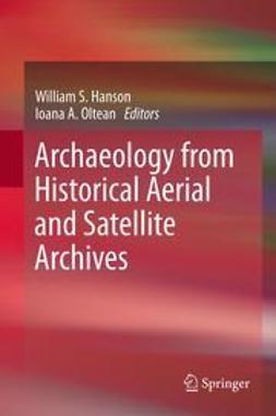
Archaeology from Historical Aerial and Satellite Archives
1. A Spy in the Sky: The Potential of Historical Aerial and Satellite Photography for Archaeological Research
William S. Hanson, Ioana A. Oltean
2. The Aerial Reconnaissance Archives: A Global Aerial Photographic Collection
David C. Cowley, Lesley M. Ferguson, Allan Williams
3. Blitzing the Bunkers: Finding Aids – Past, Present and Future
Peter McKeague, Rebecca H. Jones
4. Declassified Intelligence Satellite Photographs
Martin J. F. Fowler
5. First World War Aerial Photography and Medieval Landscapes: Moated Sites in Flanders
Birger Stichelbaut, Wim Clercq, Davy Herremans, Jean Bourgeois
6. The Use of First World War Aerial Photographs by Archaeologists: A Case Study from Fromelles, Northern France
Tony Pollard, Peter Barton
7. Historic Vertical Photography and Cornwall’s National Mapping Programme
Andrew Young
8. The Use of Historical Aerial Photographs in Italy: Some Case Studies
Patrizia Tartara
9. A Lost Archaeological Landscape on the Lower Danube Roman
Ioana A. Oltean
10. The Value and Significance of Historical Air Photographs for Archaeological Research: Some Examples from Central and Eastern Europe
Zsolt Visy
11. Archaeology from Aerial Archives in Spain and Portugal: Two Examples from the Atlantic Seaboard
Iván Fumadó Ortega, José Carlos Sánchez-Pardo
12. Soviet Period Air Photography and Archaeology of the Bronze Age in the Southern Urals of Russia
Natal’ya S. Batanina, Bryan K. Hanks
13. Historical Aerial Imagery in Jordan and the Wider Middle East
Robert Bewley, David Kennedy
14. “Down Under in the Marshes”: Investigating Settlement Patterns of the Early Formative Mound-Building Cultures of South-Eastern Uruguay Through Historic Aerial Photography
José Iriarte
15. The Archaeological Exploitation of Declassified Satellite Photography in Semi-arid Environments
Anthony R. Beck, Graham Philip
16. Uses of Declassified
Rog Palmer
17. Pixels, Ponds and People: Mapping Archaeological Landscapes in Cambodia Using Historical Aerial and Satellite Imagery
Damian Evans, Elizabeth Moylan
18. Integrating Aerial and Satellite Imagery: Discovering Roman Imperial Landscapes in Southern Dobrogea (Romania)
Ioana A. Oltean, William S. Hanson
Avainsanat: Social Sciences, Archaeology, Anthropology, Geographical Information Systems/Cartography
- Tekijä(t)
- Hanson, William S.
- Oltean, Ioana A.
- Julkaisija
- Springer
- Julkaisuvuosi
- 2013
- Kieli
- en
- Painos
- 2013
- Sivumäärä
- 24 sivua
- Kategoria
- Yhteiskunta
- Tiedostomuoto
- E-kirja
- eISBN (PDF)
- 9781461445050


