Showalter, Pamela S.
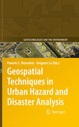
Geospatial Techniques in Urban Hazard and Disaster Analysis
1. Introduction
Pamela S. Showalter, Yongmei Lu
2. Modeling Sea-Level Rise and Surge in Low-Lying Urban Areas Using Spatial Data, Geographic Information Systems, and Animation Methods
E. Lynn Usery, Jinmu Choi, Michael P. Finn
3. Urban Expansion and Sea-Level Rise Related Flood Vulnerability for Mumbai (Bombay), India Using Remotely Sensed Data
Firooza Pavri
4. A GIS for Flood Risk Management in Flanders
Pieter Deckers, Wim Kellens, Johan Reyns, Wouter Vanneuville, Philippe Maeyer
5. Using Geographic Information Science to Estimate Vulnerable Urban Populations for Flood Hazard and Risk Assessment in New York City
Juliana Maantay, Andrew Maroko, Gretchen Culp
6. Geo-Information Technology for Infrastructural Flood Risk Analysis in Unplanned Settlements: A Case Study of Informal Settlement Flood Risk in the Nyabugogo Flood Plain, Kigali City, Rwanda
Jean Pierre Bizimana, Michele Schilling
7. A Respiratory Riskscape for Texas Cities: A Spatial Analysis of Air Pollution, Demographic Attributes and Deaths from 2000 Through 2004
Susan M. Macey
8. Spatial Distribution of Toxic Release Inventory Sites in Chicago Area: Is There Environmental Inequity?
Fahui Wang, Yvette C. Feliberty
9. Risk and Exposure to Extreme Heat in Microclimates of Phoenix, AZ
Darren M. Ruddell, Sharon L. Harlan, Susanne Grossman-Clarke, Alexander Buyantuyev
10. Wildfire Risk Analysis at the Wildland Urban Interface in Travis County, Texas
Yongmei Lu, Lori Carter, Pamela S. Showalter
11. Early Warning of Food Security Crises in Urban Areas: The Case of Harare, Zimbabwe, 2007
Molly E. Brown, Christopher C. Funk
12. Spatial Information Technologies for Disaster Management in China
Jing Li, Yunhao Chen, A-du Gong, Weiguo Jiang
13. A Cybercartographic Tool for Supporting Disaster Prevention Planning Processes and Emergency Management in Mexico City
Elvia Martínez Viveros, Fernando López Caloca
14. Integration of Tsunami Analysis Tools into a GIS Workspace – Research, Modeling, and Hazard Mitigation efforts Within NOAA’s Center for Tsunami Research
Nazila Merati, Christopher Chamberlin, Christopher Moore, Vasily Titov, Tiffany C. Vance
15. Utilizing New Technologies in Managing Hazards and Disasters
Ronald T. Eguchi, Charles K. Huyck, Shubharoop Ghosh, Beverley J. Adams, Anneley McMillan
16. Remote Sensing and GIS Data/Information in the Emergency Response/Recovery Phase
Michael E. Hodgson, Bruce A. Davis, Jitka Kotelenska
17. Investigating Recovery Patterns in Post Disaster Urban Settings: Utilizing Geospatial Technology to Understand Post-Hurricane Katrina Recovery in New Orleans, Louisiana
Steven M. Ward, Michael Leitner, John Pine
18. Space and Time Changes in Neighborhood Recovery After a Disaster Using a Spatial Video Acquisition System
Andrew J. Curtis, Jacqueline W. Mills, Timothy McCarthy, A. Stewart Fotheringham, William F. Fagan
19. Pre-evacuation Trip Behavior
Melany Noltenius, Bruce A. Ralston
20. Micro-Level Emergency Response: 3D Geometric Network and an Agent-Based Model
Jinmu Choi, Jiyeong Lee
21. A Planning Support System for Terror-Resistant Urban Communities
Xinhao Wang, Joshua S. Belhadj, Heng Wei
Keywords: Geography, Geographical Information Systems/Cartography, Remote Sensing/Photogrammetry, Environmental Management, Landscape/Regional and Urban Planning
- Author(s)
- Showalter, Pamela S.
- Lu, Yongmei
- Publisher
- Springer
- Publication year
- 2010
- Language
- en
- Edition
- 1
- Series
- Geotechnologies and the Environment
- Page amount
- 14 pages
- Category
- Natural Sciences
- Format
- Ebook
- eISBN (PDF)
- 9789048122387


